DIY Drone Registration and Airspace Declaration Guide
I. UOM Platform Registration
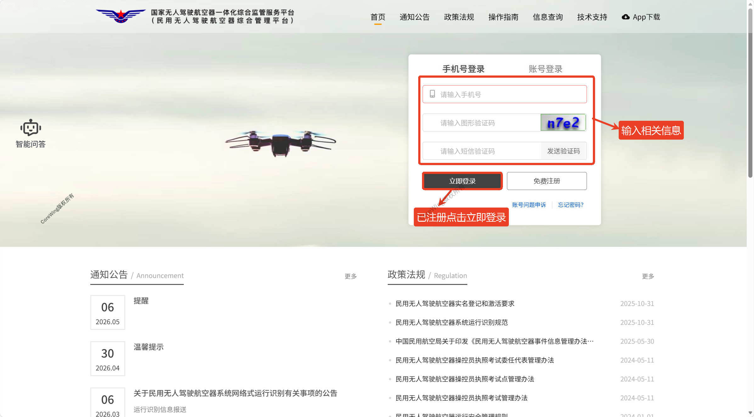
- Enter https://uom.caac.gov.cn/ in your browser to access the UOM official website
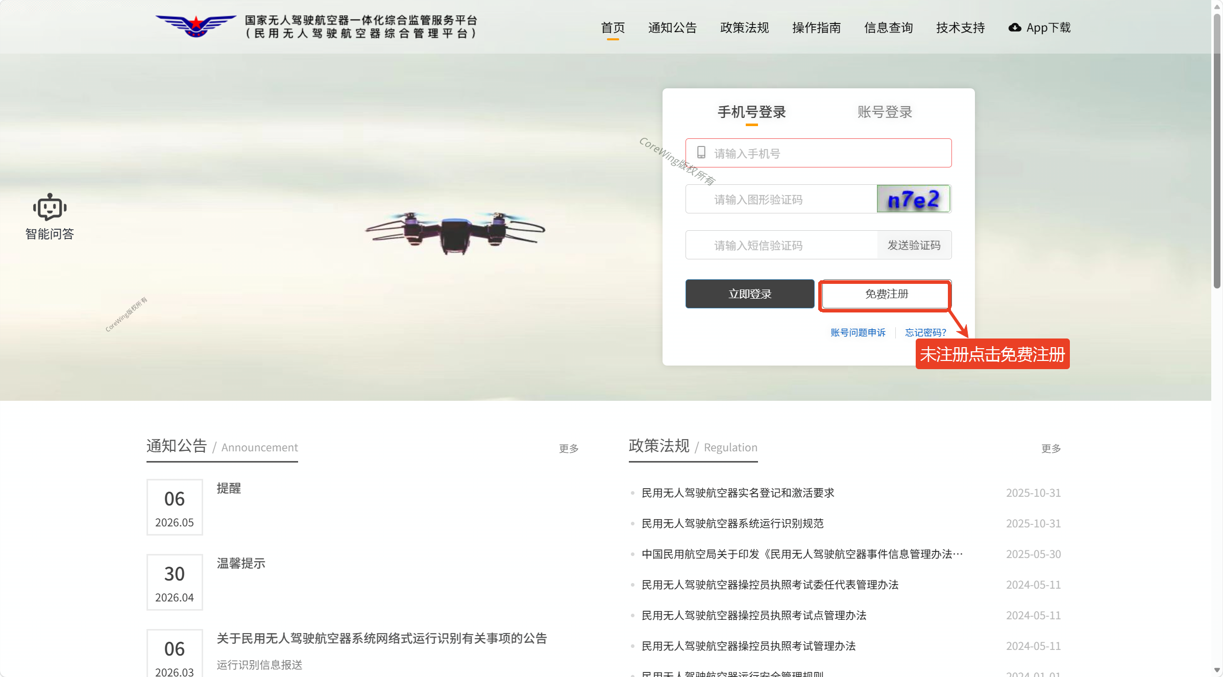
- If not registered, click
Free Registrationand follow the registration steps, then log in
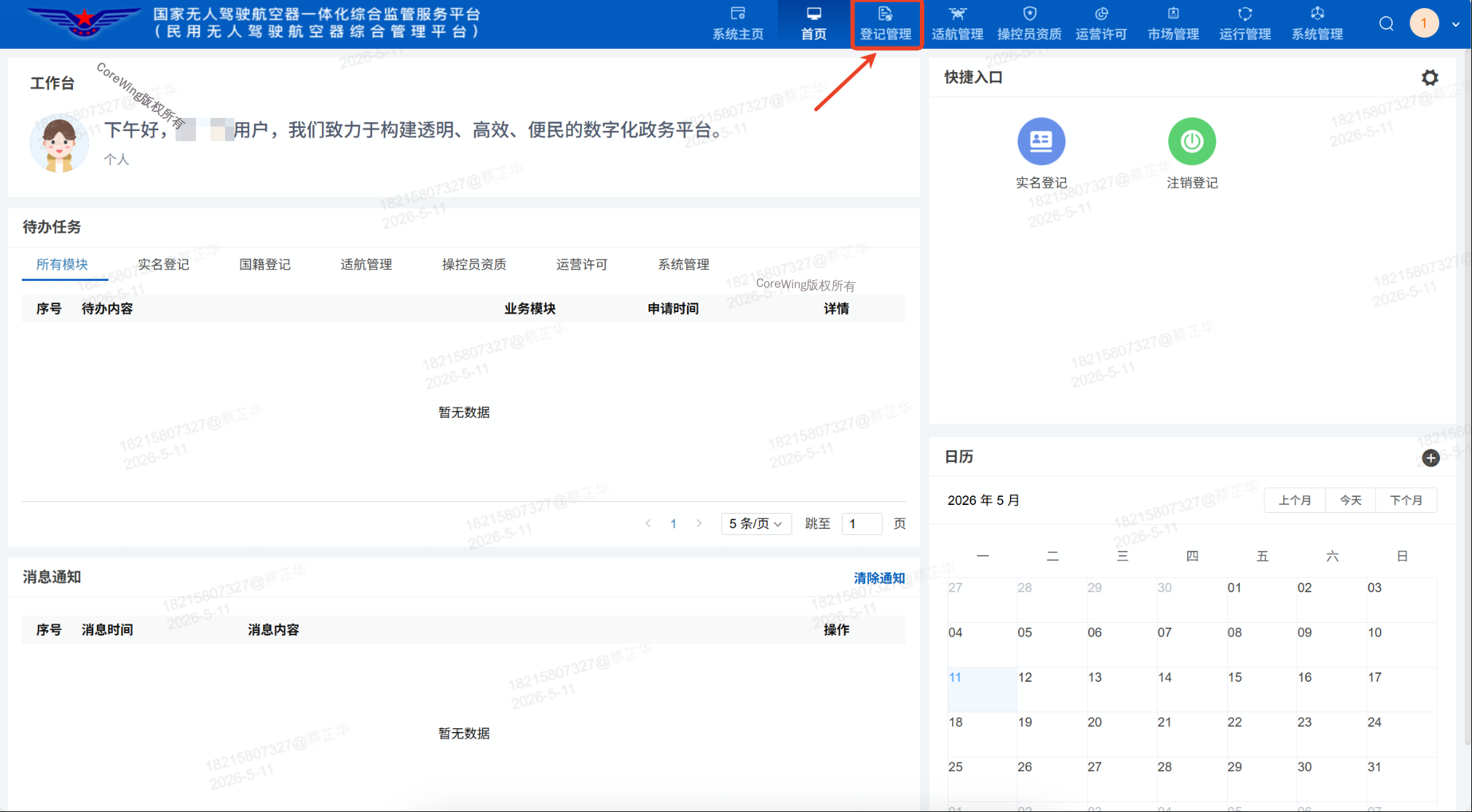
- After entering the homepage, click
Registration Managementand selectReal-name Registration
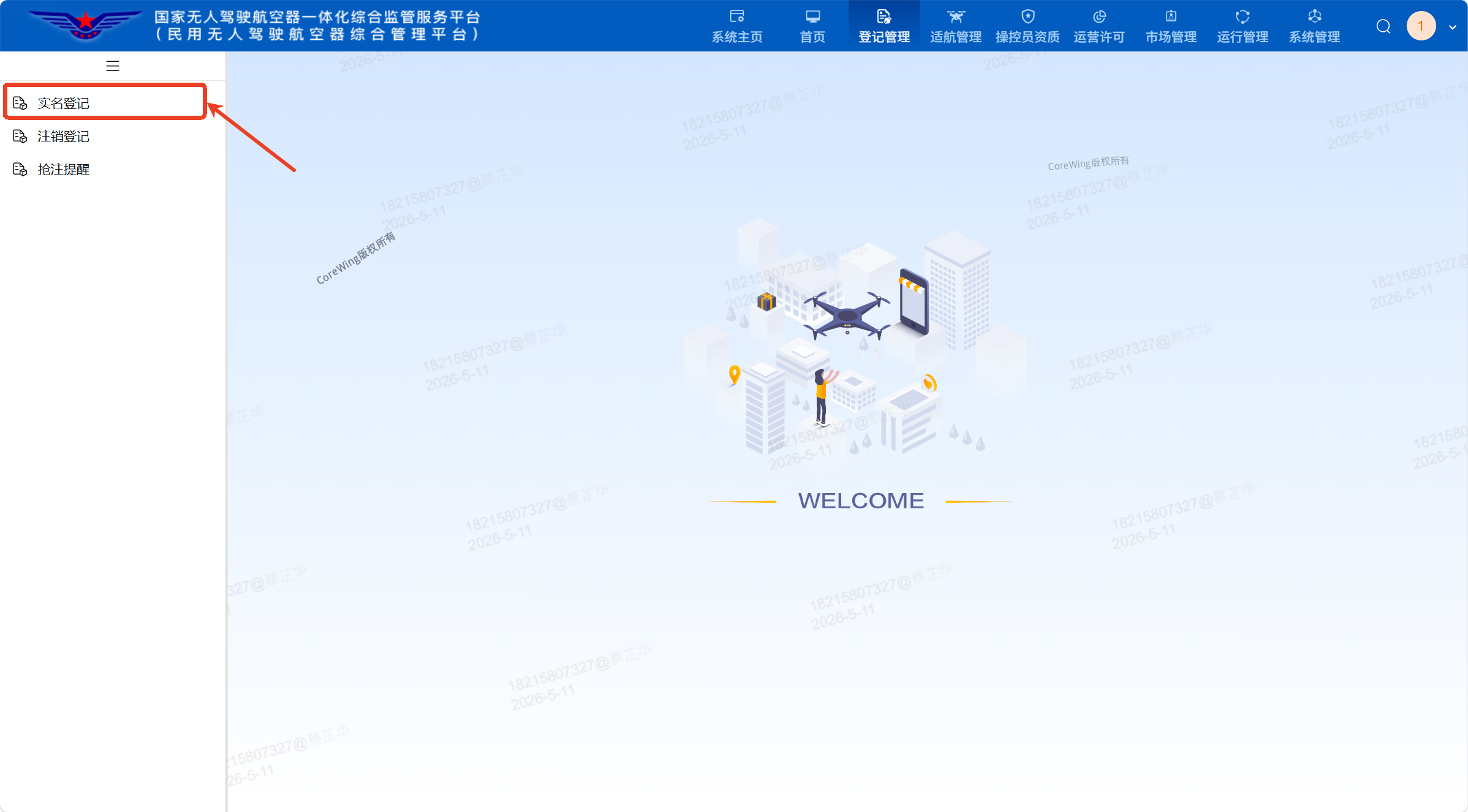
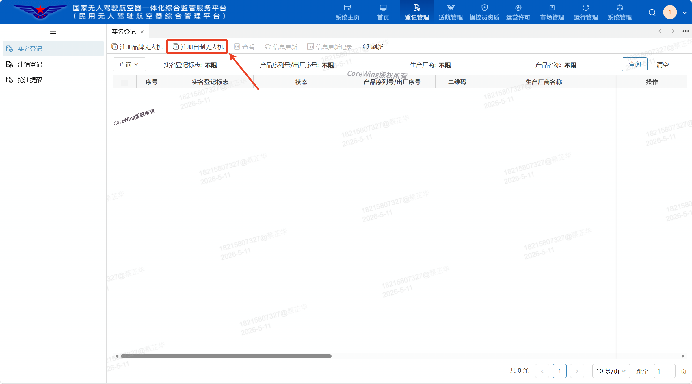
- Select
Register Custom Drone
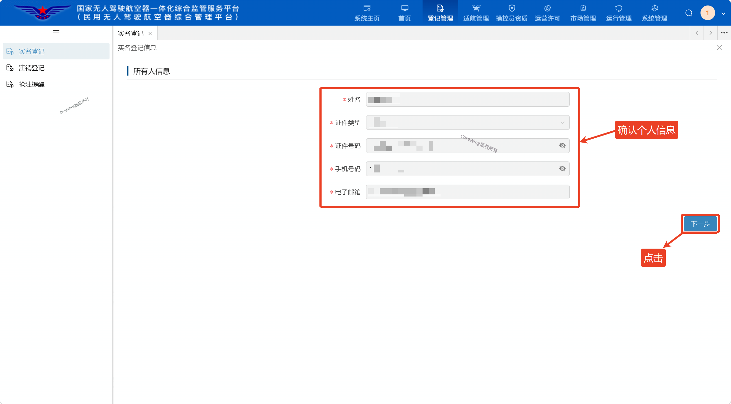
- Verify that
Real-name Registration Informationis correct, then clickNextif there are no errors
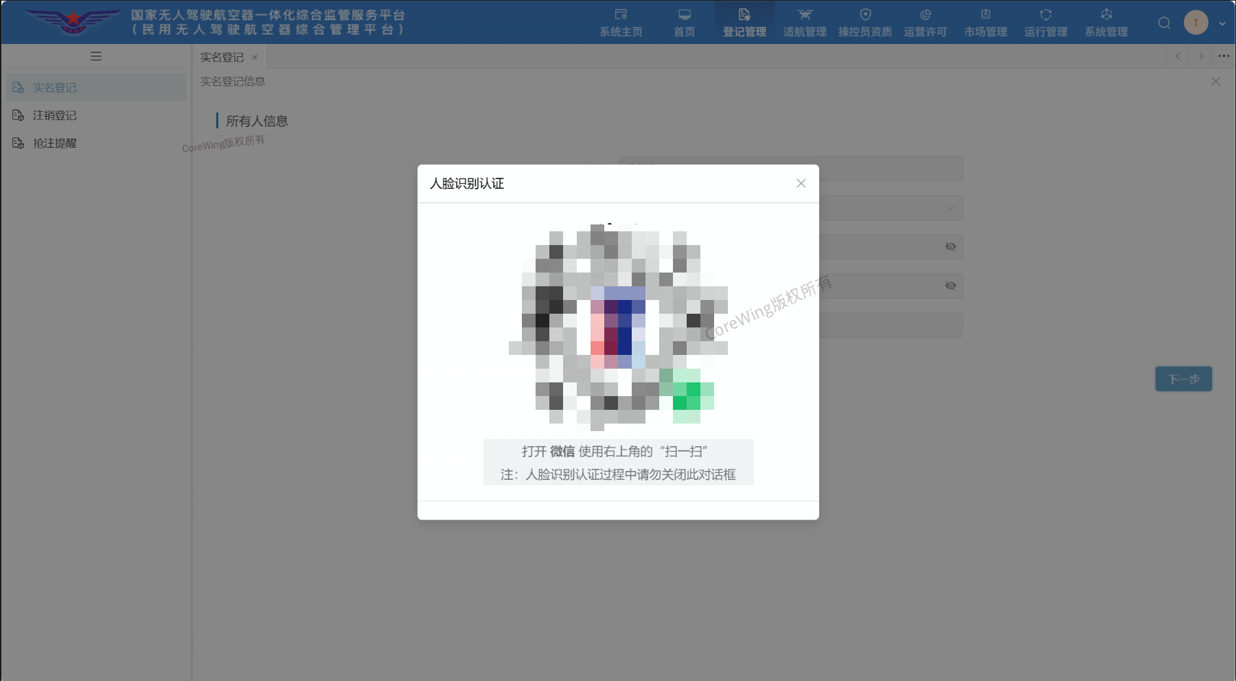
- Open WeChat and use the
Scanin the upper right corner to scan the mini-program code forFacial Recognition Authentication
Important
Do not close this dialog box during facial recognition authentication!!!
- Fill in
Unmanned Aircraft Information
Important
Only fill in the fields marked with asterisks, fields without asterisks can be left blank
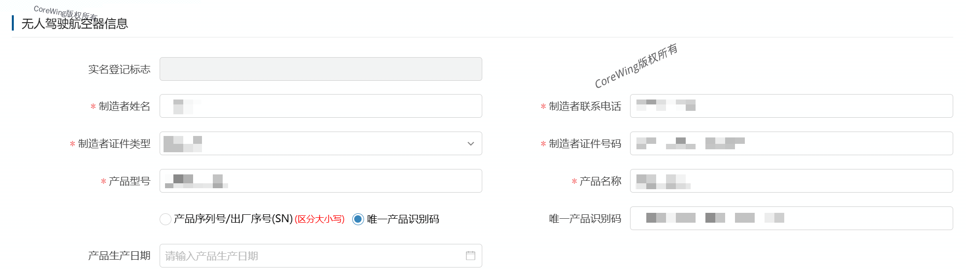
Important
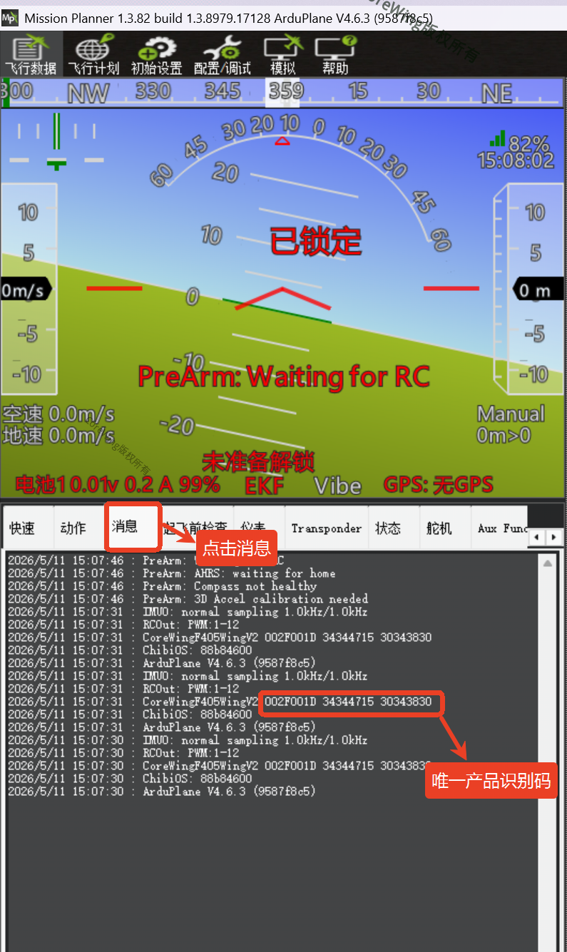
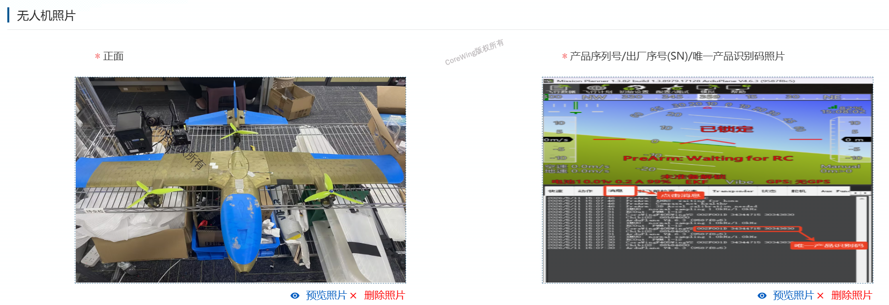
Select Unique Product Identification Code for the flight controller unique ID
Unique product identification code acquisition methods:
- ArduPilot firmware:
- iNav firmware:

Key field explanations:
- Product model: Enter the name of your custom-built aircraft, not the flight controller name
- Product name: Enter the name of your custom-built aircraft, not the flight controller name
- Fill in
Basic Data
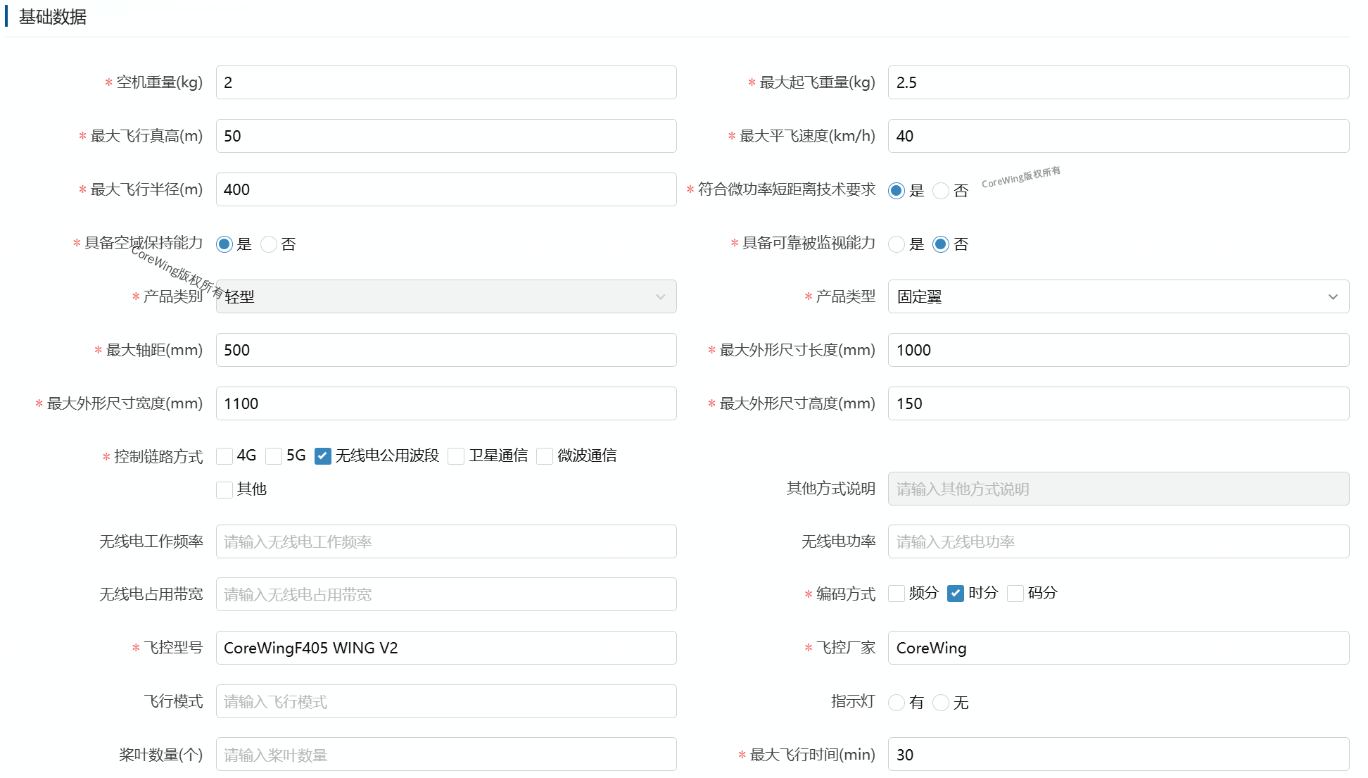
- Empty weight (kg): The weight of the drone without any mission payloads or fuel, but including all permanently installed fixed components, including:
frame, wings, tail, motors, ESC, flight controller, GPS module, receiver, servos, propellers, RID module, all connecting cables, landing gear - Maximum takeoff weight (kg): The maximum takeoff weight permitted by the drone's design and that you will actually use, including:
empty weight + all payloads (camera, gimbal, mounted objects) + all fuel / battery - Maximum flight altitude (m): The maximum vertical flight height of the drone relative to the ground directly below (not relative to the takeoff point), compliance reference value:
Micro drone: ≤50m, Light/Small drone: ≤119m (Blue zone flyable airspace). If you enter the maximum altitude limit of the flight controller (e.g., 1000m), the system will classify it as a high-risk device, and control requirements will be upgraded - Maximum level flight speed (km/h): The maximum stable speed the drone can achieve during horizontal straight flight, compliance reference value:
Micro drone: ≤40km/h, Light drone: ≤100km/h. If the entered speed exceeds the limit for the corresponding category, the system will automatically upgrade the classification - Maximum flight radius (m): The maximum horizontal distance from the operator when flying within visual line of sight. Enter a value not greater than
500m, as this is the practical limit for most visual flight operations. If you enter the maximum transmission distance (e.g., 5km, 10km), the system will determine that the drone has beyond visual line of sight (BVLOS) capability, significantly upgrading control requirements. BVLOS flight requires prior approval regardless of circumstances and is unrelated to registration parameters - Complies with low-power short-distance technical requirements: Whether the radio transmission equipment meets the national technical requirements for low-power short-distance radio devices. If you purchased brand-name receivers, high-frequency heads, video transmitters, etc., from the market, select
Yes - Has airspace holding capability: Whether the drone has the ability to automatically maintain flight altitude and position. If it has any of the following functions: altitude hold, position hold, cruise, or return to home, select
Yes - Has reliable surveillance capability: If an RID module is installed, select
Yes - Product type: Select according to the actual situation. Both
Fixed-wingandVTOL Fixed-wingshould be selected as fixed-wing - Maximum wheelbase (mm): The maximum distance between two motor shafts on the drone, in millimeters
- Maximum overall length (mm): The maximum length from front to back of the drone, in millimeters
- Maximum overall width (mm): The maximum width from left to right of the drone, in millimeters
- Maximum overall height (mm): The maximum height from the lowest to the highest point of the drone, including landing gear and antennas
- Control link method: Select according to your remote control system. For 2.4GHz remote controls and receivers, select the public radio frequency band. 915MHz is illegal equipment in China
- Encoding method: Generally select
Time Division - Flight controller model: CoreWing flight controller. Fill in according to the product name on the paper manual in the packaging box
- Flight controller manufacturer: CoreWing
- Maximum flight time (min): It is recommended to enter a shorter time, not exceeding one hour
- Fill in
Power System

Key field explanations:
- Battery model: Fill in according to the actual battery model and capacity used for flight
- Battery manufacturer: Fill in according to the actual battery manufacturer used for flight
- Fill in
Other Equipment

- Fill in
Remote Control Station

Key field explanations:
- Control method: Fill in according to the actual operation method used for flight. APP, remote control, and ground control station are all commonly used, it is recommended to select all three
- Has status indication function: Select
Yes
- Fill in
Emergency Handling
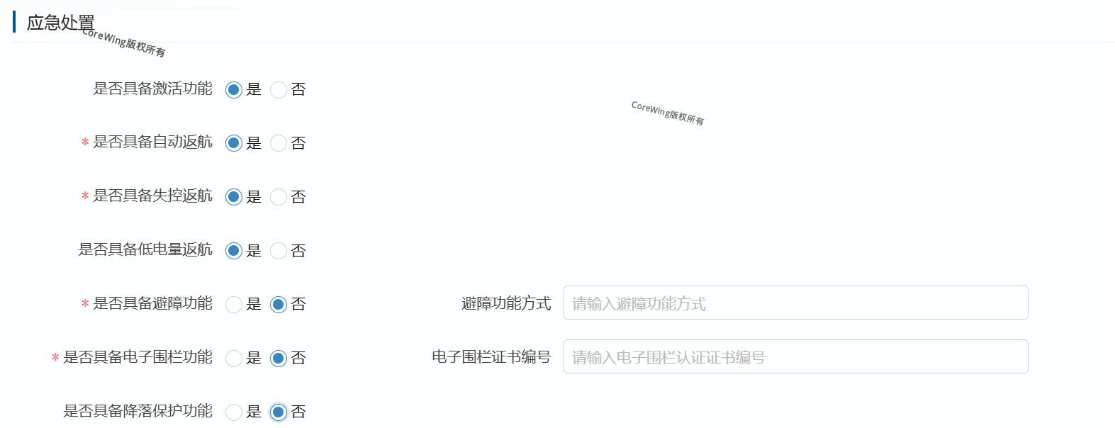
Key field explanations:
- Has activation function: This is optional and can be left blank. If the flight controller or RID has activation capability, select
Yes - Has automatic return to home: For ArduPilot and iNav firmware, select
Yes - Has lost signal return to home: For ArduPilot and iNav firmware, select
Yes - Has low battery return to home: For ArduPilot and iNav firmware, select
Yes - Has obstacle avoidance function: According to the actual situation. If not installed, select
No. If installed, consult the obstacle avoidance manufacturer for the function method - Has geofence function: For ArduPilot and iNav firmware, select
No - Has landing protection function: For ArduPilot and iNav firmware, select
No
Usage Restrictionsis not marked with an asterisk and can be filled in or left blank

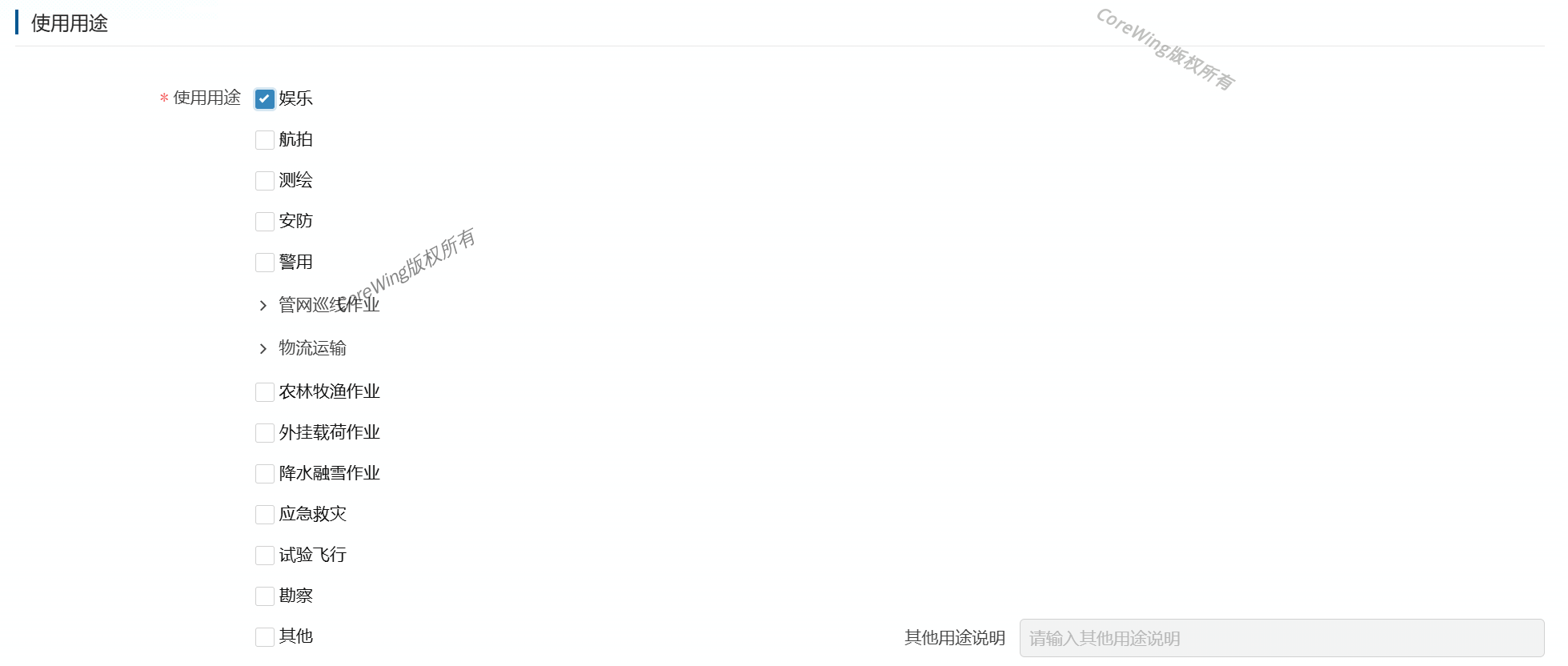
- Fill in
Intended Useaccording to the actual usage purpose
- Upload
Drone Front PhotoandUnique Product Identification Code Photo
- Check
Declarationand click Complete Registration

II. Unmanned Aircraft Registration
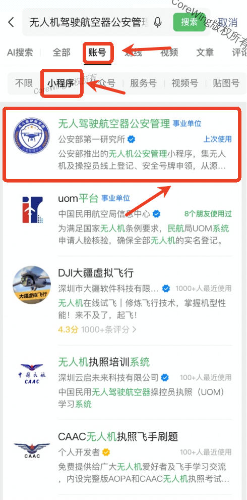
- Open WeChat and search for
Unmanned Aircraft Public Security Management Platform, clickAccount, selectMini Program
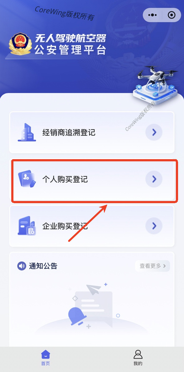
- Select
Personal Purchase Registration
- Fill in personal information according to your actual situation. The drone information must be consistent with the information on the UOM platform
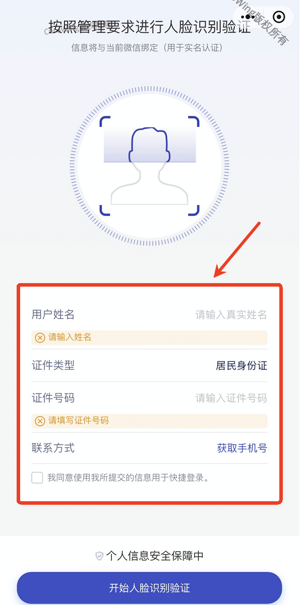
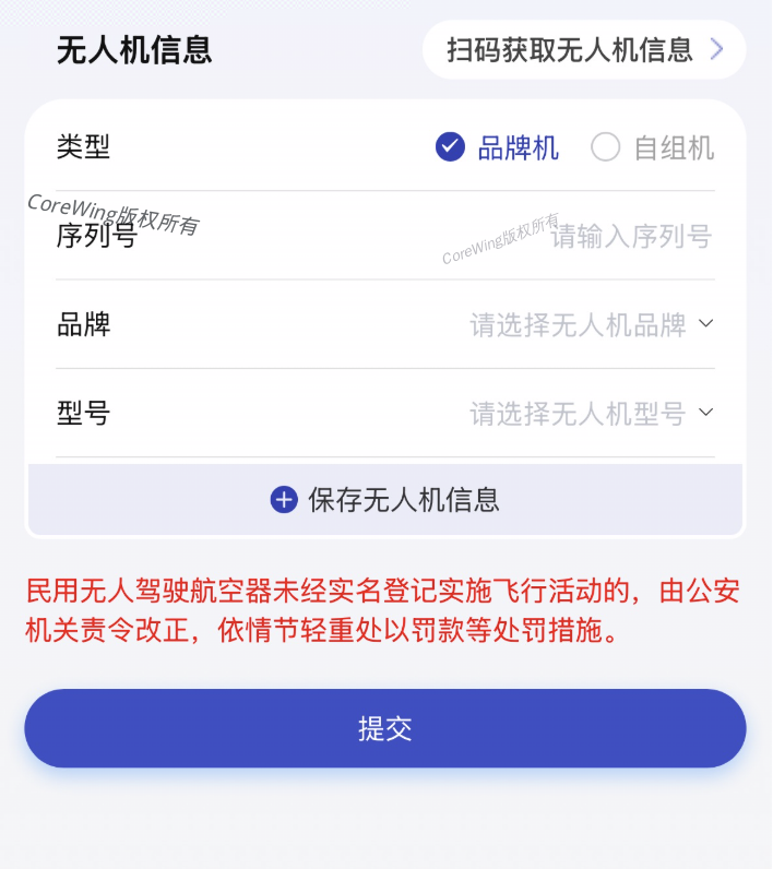
- Click on "Mine", select "Personal Ownership Registration Records" to view your registration information
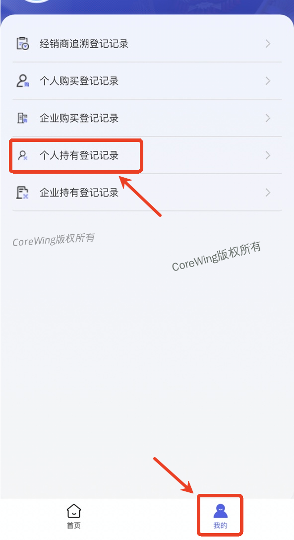
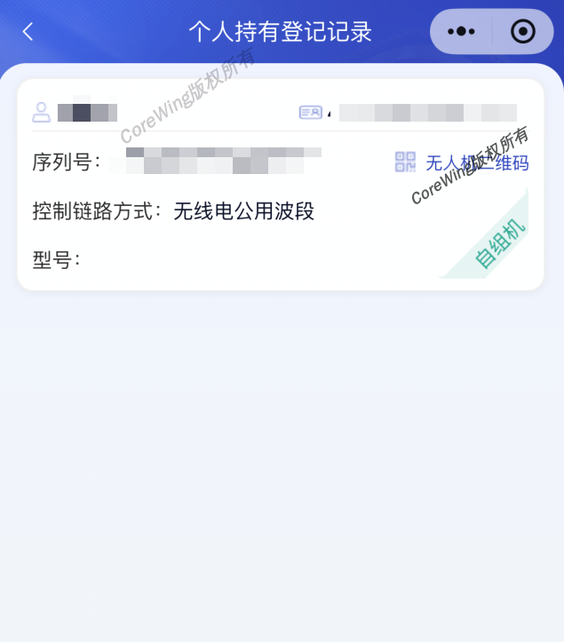
III. UOM Exam
Important
Without passing the exam, applications for flight declarations in white zones will be rejected immediately!!!
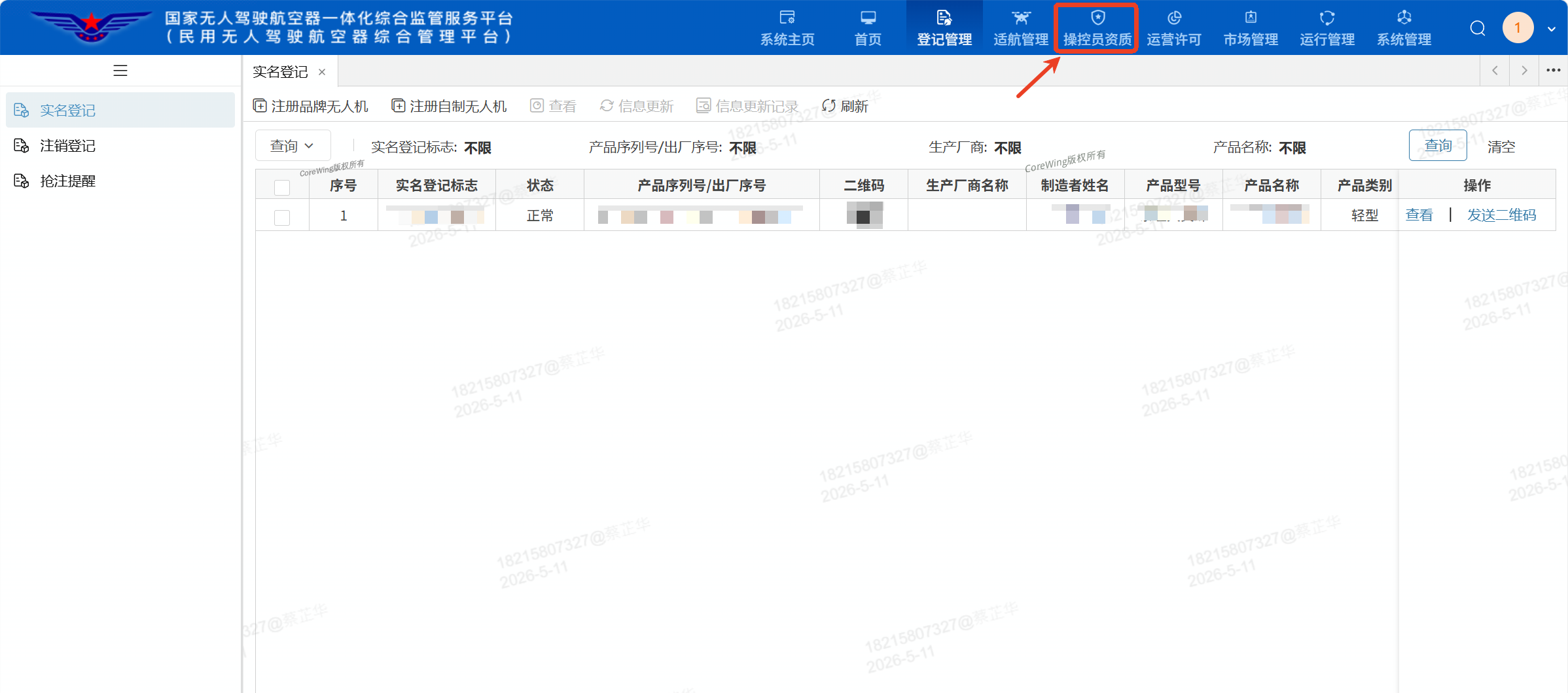
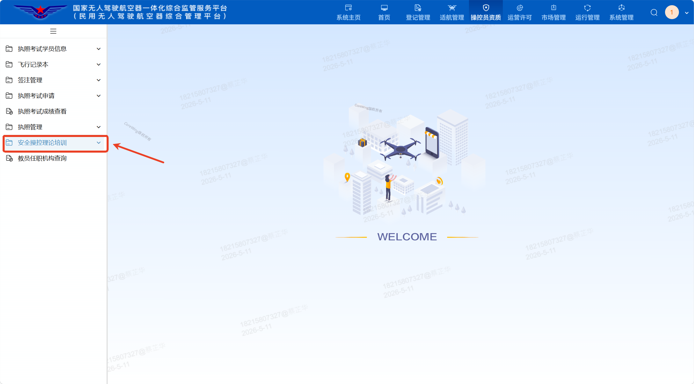
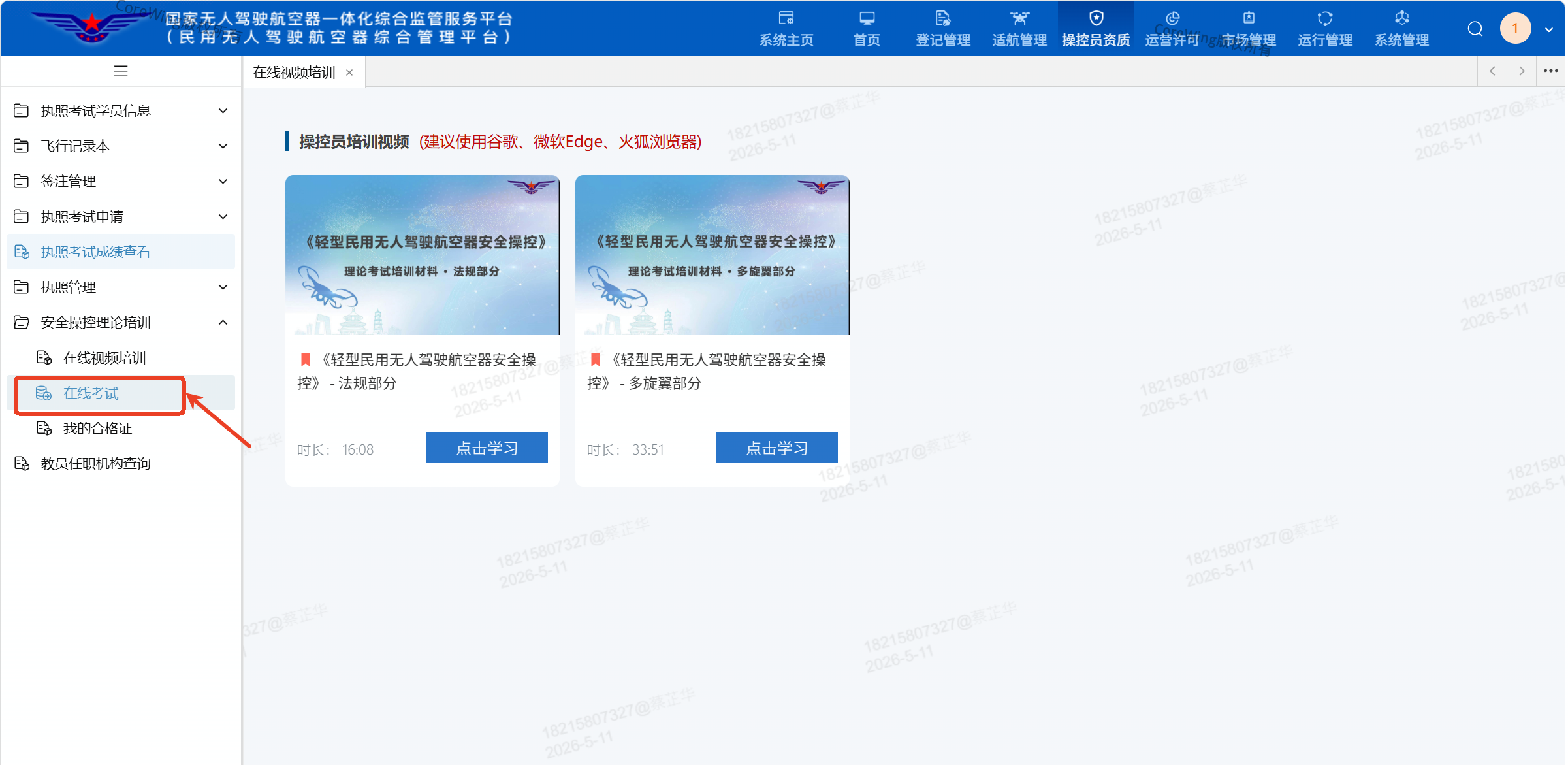
- After entering the homepage, click
Operator Qualifications, then clickSafety Operation Theory Training
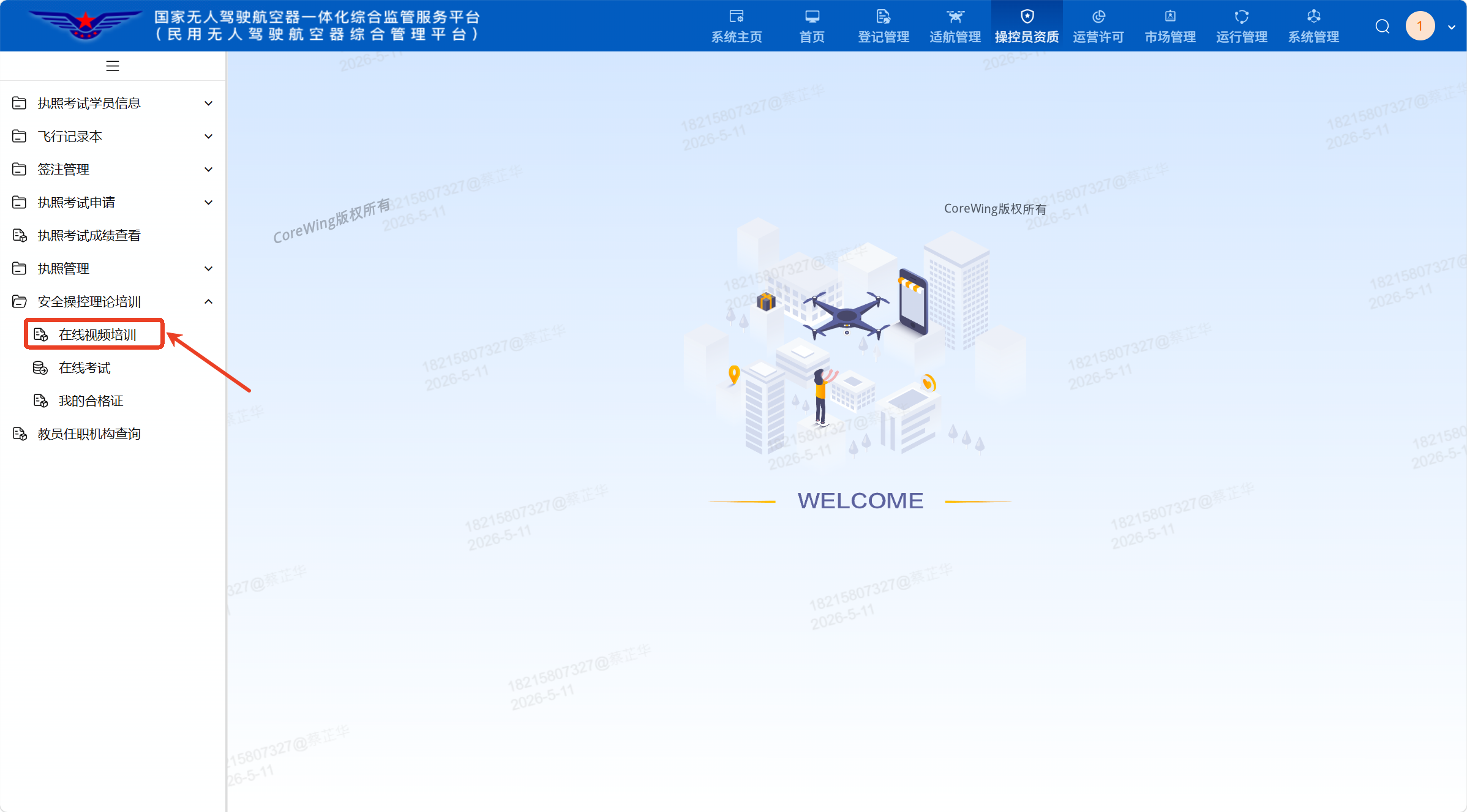
- Click
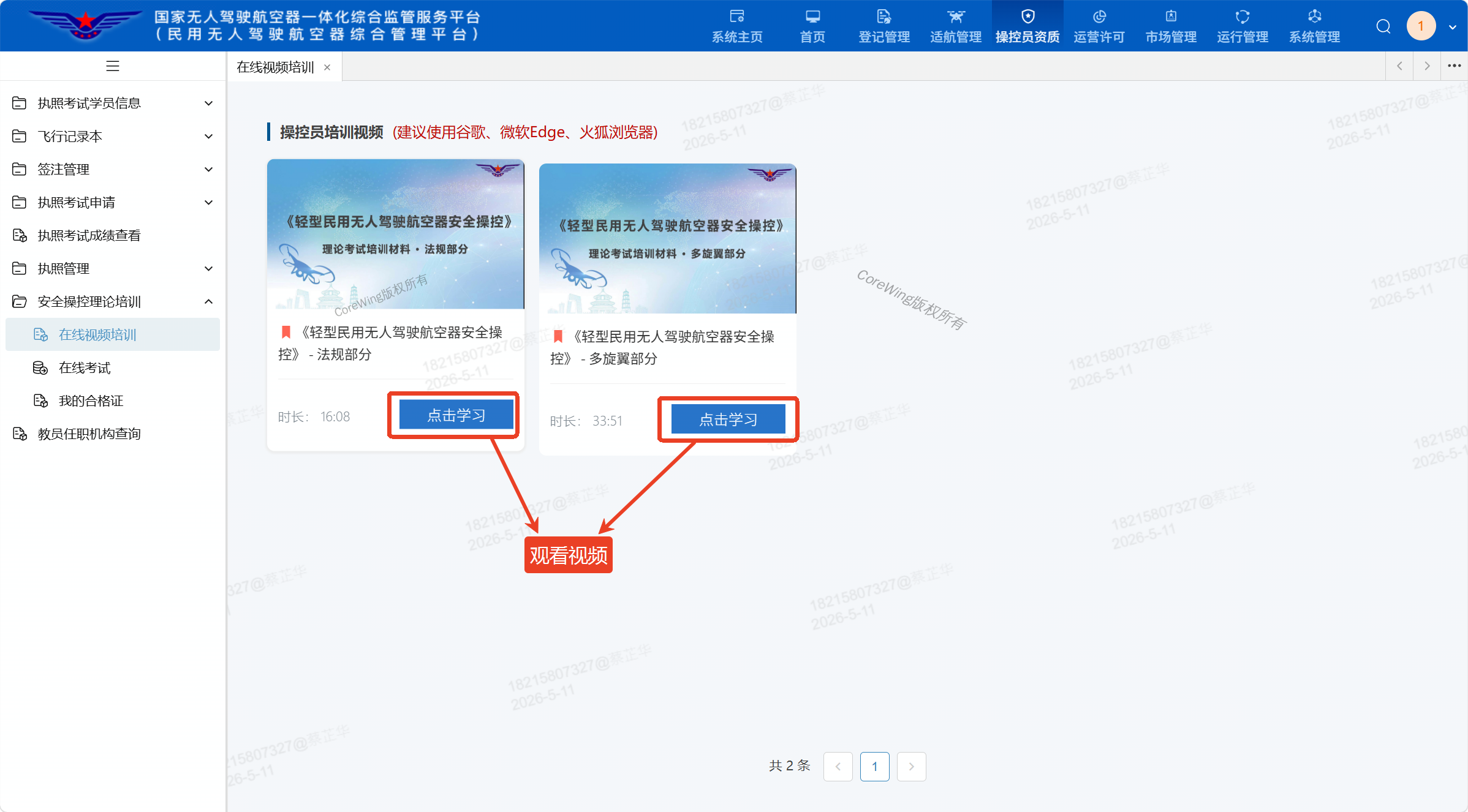
Online Exam Video Training, then click Study
Important
You must complete at least 45 minutes of study on the same day before taking the exam!
- After completing 45 minutes of study, click
Online Examto take the exam. A score of 80 or higher is required to pass.
IV. Airspace Application
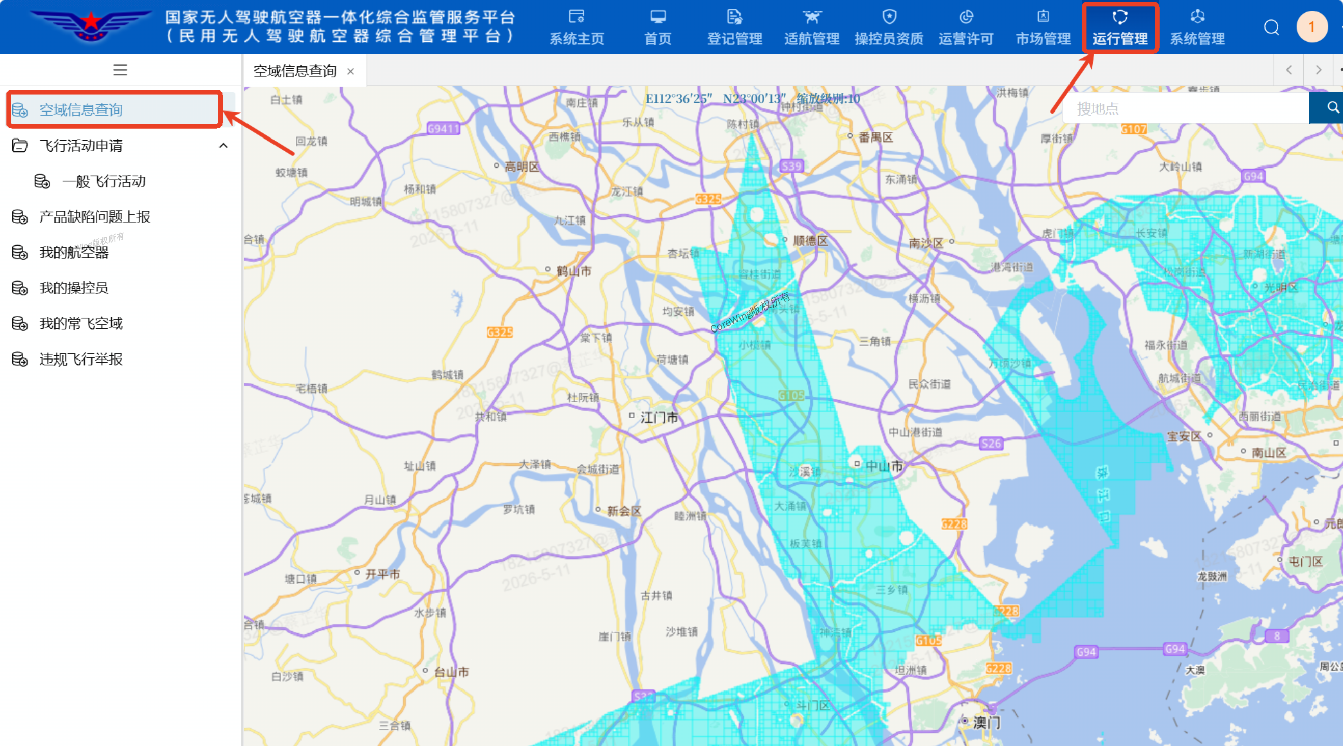
- After entering the homepage, click
Operations Management, then clickAirspace Information Queryto check the division of the desired airspace for flight
Important
Blue: Micro, light, and small drones. Micro drones have a true altitude ≤ 50m, while light/small drones have a true altitude ≤ 120m. All flights must be within visual line of sight (VLOS). After registration with UOM and public security systems, flight declaration is exempt.
White Zone: Regardless of drone type, advance application and approval are required.
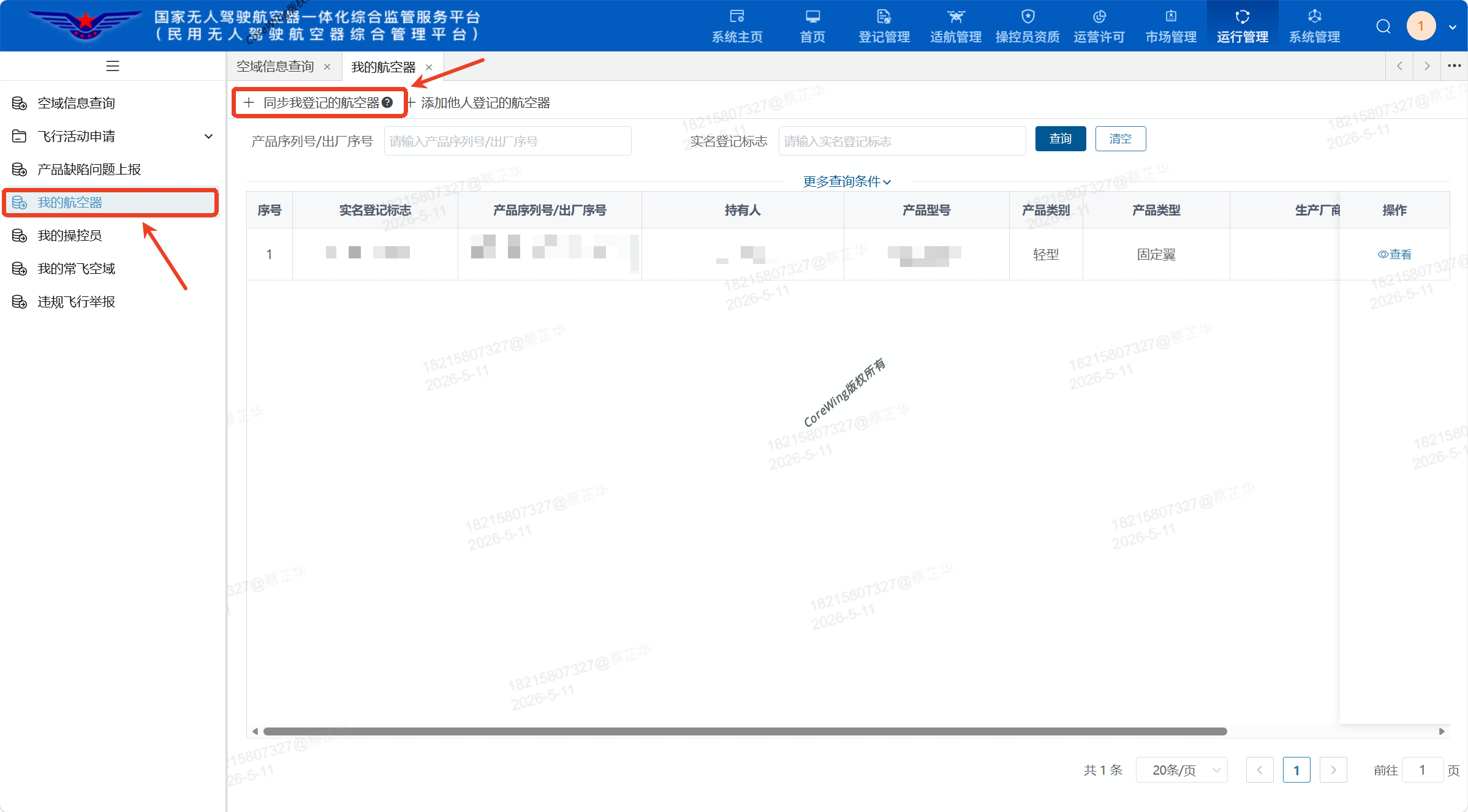
- Click
My Aircraft, then clickSync My Registered Aircraftto automatically sync registered aircraft
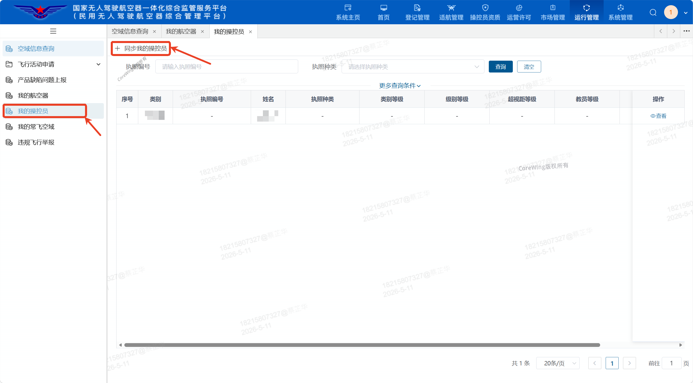
- Click
Operator, then clickSync My Operatorsto automatically sync registered aircraft
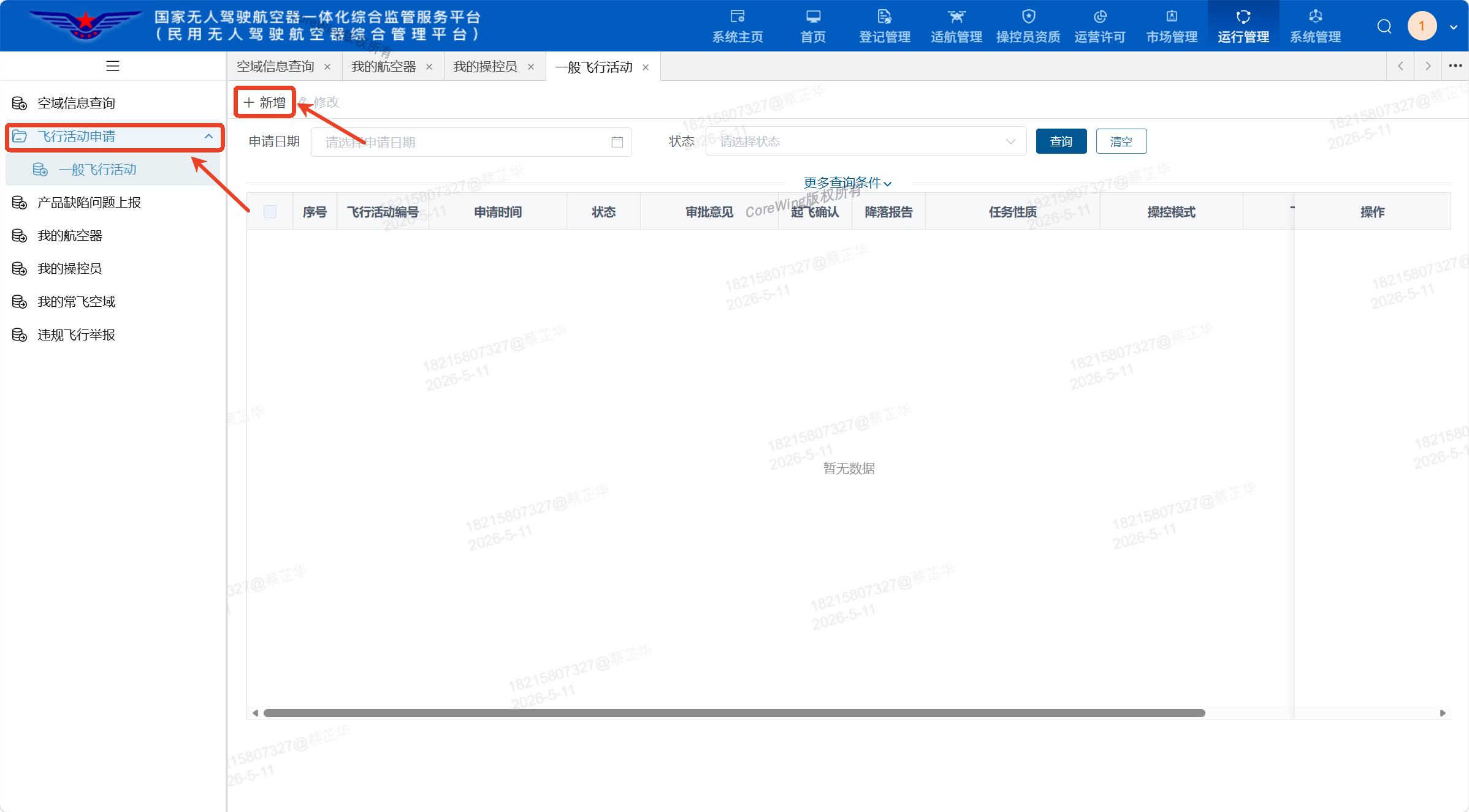
- Click
Flight Activity Application, then clickAdd New
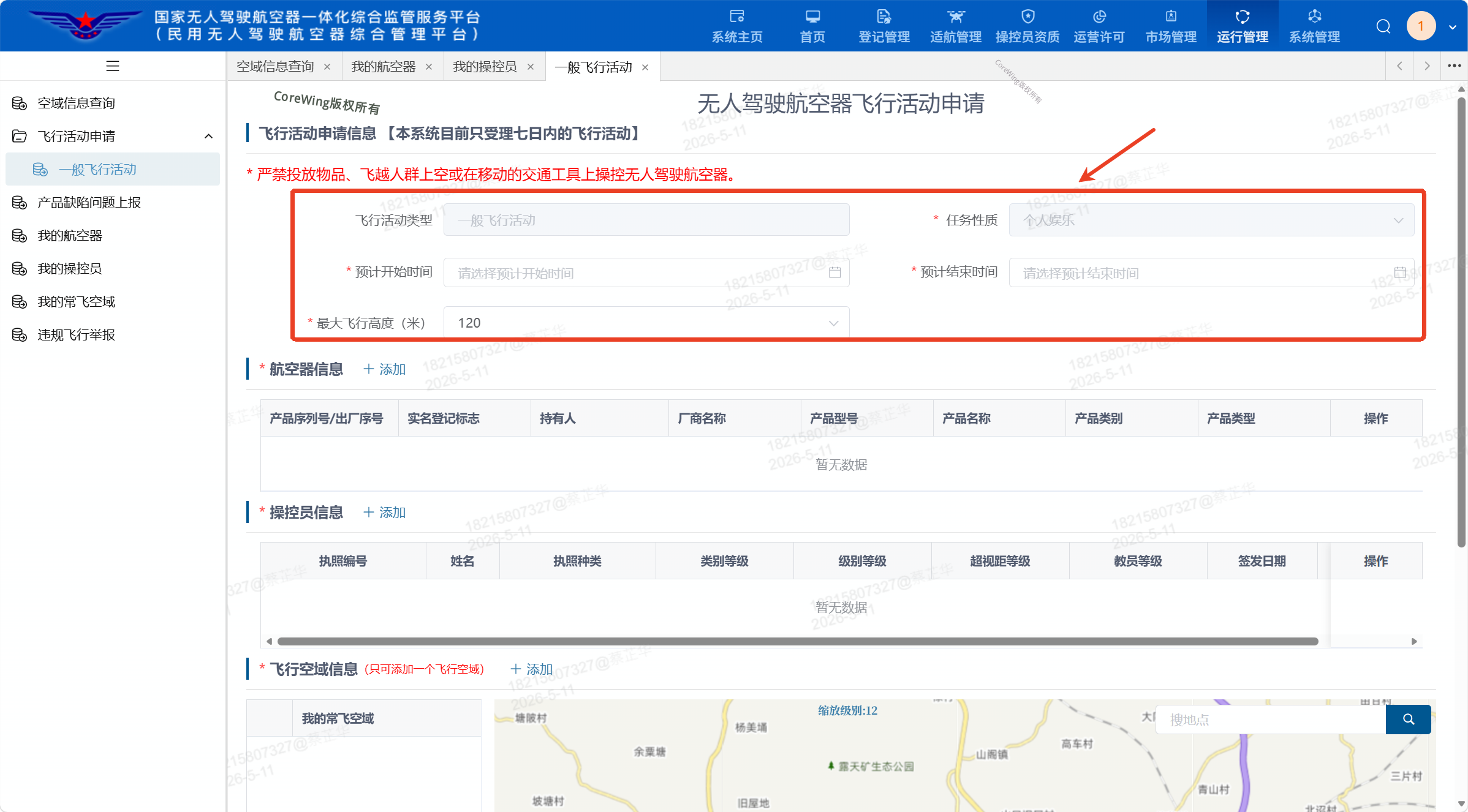
- Select flight
Estimated Start TimeandEstimated End Time, as well asMaximum Flight Altitude(it is recommended to enter smaller values for easier approval)
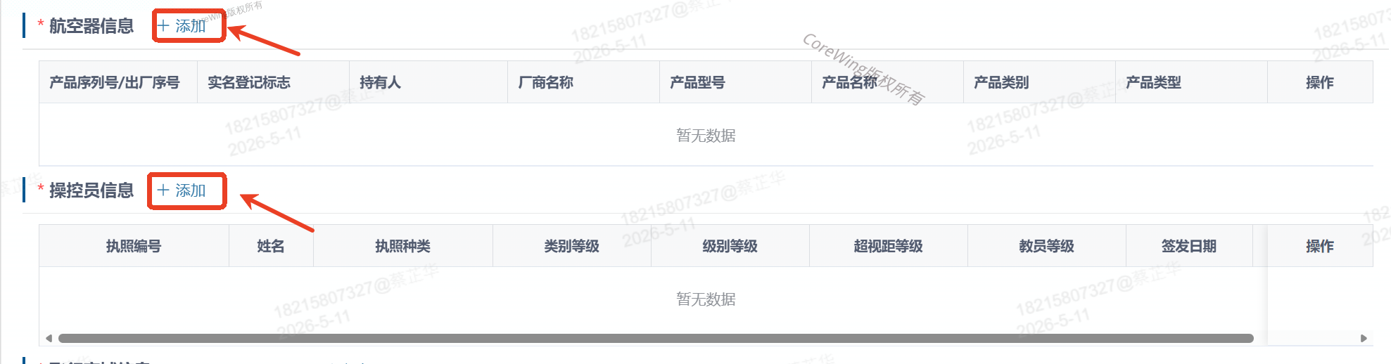
- Click to add
AircraftandOperator Information
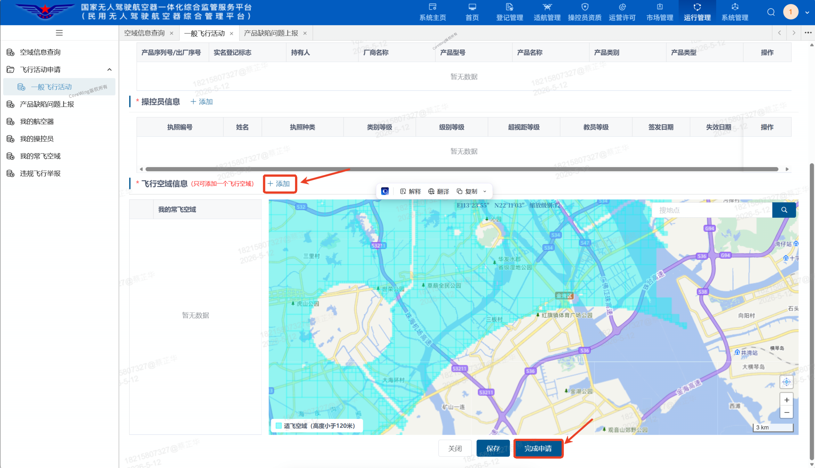
- Click to add
Flight Airspace, then clickComplete Applicationafter completion
Technical Support QR Code